Trail Walking La Roche-sur-le-Buis - 2012-10-196_j1 - Photo
 jcm17
jcm17

User

© OpenStreetMap contributors
Length
Length
20 km
Max alt
Max alt
1163 m
Uphill gradient
Uphill gradient
991 m
Km-Effort
Km-Effort  
33 km
Min alt
Min alt
479 m
Downhill gradient
Downhill gradient
905 m
Boucle
Boucle
No
Creation date :
2014-12-10 00:00:00.0
Updated on :
2014-12-10 00:00:00.0

(0 Reviews)

Walking
Walking
6h45
Difficulty : Medium

Scan this QR Code to open this trail in the SityTrail application

FREE GPS app for hiking

Logo SityTrail SityTrail

IGN / Geographical institutes

Download SityTrail from the App Store Download SityTrail from Google Play

Logo SityTrail SityTrail Plus

The world is yours!

Download SityTrail from the App Store Download SityTrail from Google Play Download SityTrail on Huawei AppGallery

About

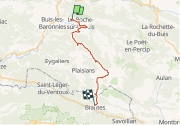
Trail Walking of 20 km to be discovered at Auvergne-Rhône-Alpes, Drôme, La Roche-sur-le-Buis. This trail is proposed by jcm17.

Description

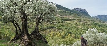
Baronnies J1 de Buis à Brantes
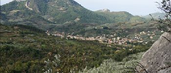
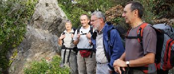
Elevation profile

Photos

Points of interest

Point of interest La Roche-sur-le-Buis - Ph1 - Photo
jcm17
LA ROCHE-SUR-LE-BUIS 
Point of interest La Roche-sur-le-Buis - Ph1 - Photo
jcm17
LA ROCHE-SUR-LE-BUIS 
Point of interest La Roche-sur-le-Buis - Ph3 - Photo
jcm17
LA ROCHE-SUR-LE-BUIS 

Positioning

Country:
France
Region :
Auvergne-Rhône-Alpes
Department/Province :
Drôme
Municipality :
La Roche-sur-le-Buis
Location:
Unknown
Start:(UTM)
683701 ; 4905403 (31T) N.


Close
My subscriptions